Capitol and its Northern Periphery – site analysis

Site analysis can of course be done in many different registers. Taking the cue from Le Corbusier, we have choses to work in two modes – the aerial mode, looking at things from the sky, essentially using the visual resources of Google Earth; and then the moving human eye-level view conducting through site visits, both as a group and individually as per our areas of focus. (While designint he Capitol Le Corbusier spoke of working in plan within the 800 meter and 400 meter squares, and at the same time he carefully studied the placement of the buildings by sketching them on site – ‘the question of optics’ as he called it.) Our site analysis in this sense is an interpellation between the aerial and the human eye level, and an interpellation across 90 degrees, which is also of course Cubism 101.
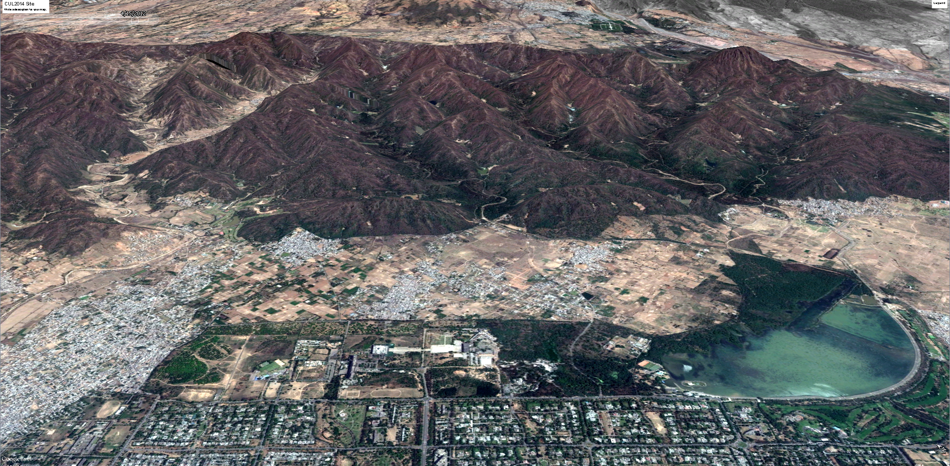
The site reveals a fragile ecological (im)balance. The planners always describe Chandigarh as located on an ideal 2 degree slope, perfect for drainiage, a consequence, supposedly, of its location at the very foothills of the Himalayas. While this description is functionally true (the site where Chandigarh is built does benefit from the 2 percent grade, but the conditions that create this grade are under-comprehended.
In fact, Chandigarh does NOT sit at the foothills of the Himalayas per se. The main Himalayan mountain range ends just north of the Chandigarh site, defined by, and draining into, the Ghagger River that emerges into the plains just to the East of the Chandigarh site. After the Ghagger, lies the dimunitive Shivalik Range of Hills which is what Chandigarh edges. The Shivaliks are not like the Himalayas in that they are not a consequence of the rising of the Indian plate as a consequence of its collision with Asia 40 million years ago. Rather, the Shivaliks are created by the local rivers of the Himalayas – essentially the tributaries of the Ghagger and the Setluj – as the deposits of alluviam that they have carted down from the Himalayas. These alluvial deposits – i.e. the Shivaliks – are then broken down by the intermittent rivulets that run down them and converted in the fine alluvial plain that is the Chandigarh site. The Shivalik Hills, in other words, are simply holding stations, temporary mounds, that are constantly being broken down to create the great Indo-Gangetic plains on which Chandigarh is site. It is only because they are persistently replenished with new alluvium from the Himalayan rivers that they do not vanish completely. And of course this cycle proceeds at a geological pace that is quite rapid as far as geological time is concerned, but imperceptible to the human sense of time.
What, then, are the consequences of this ecology for Chandigarh, and in particular for the Capitol Complex and its northern periphery – that is the primary question.
Leave a comment