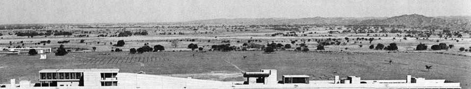
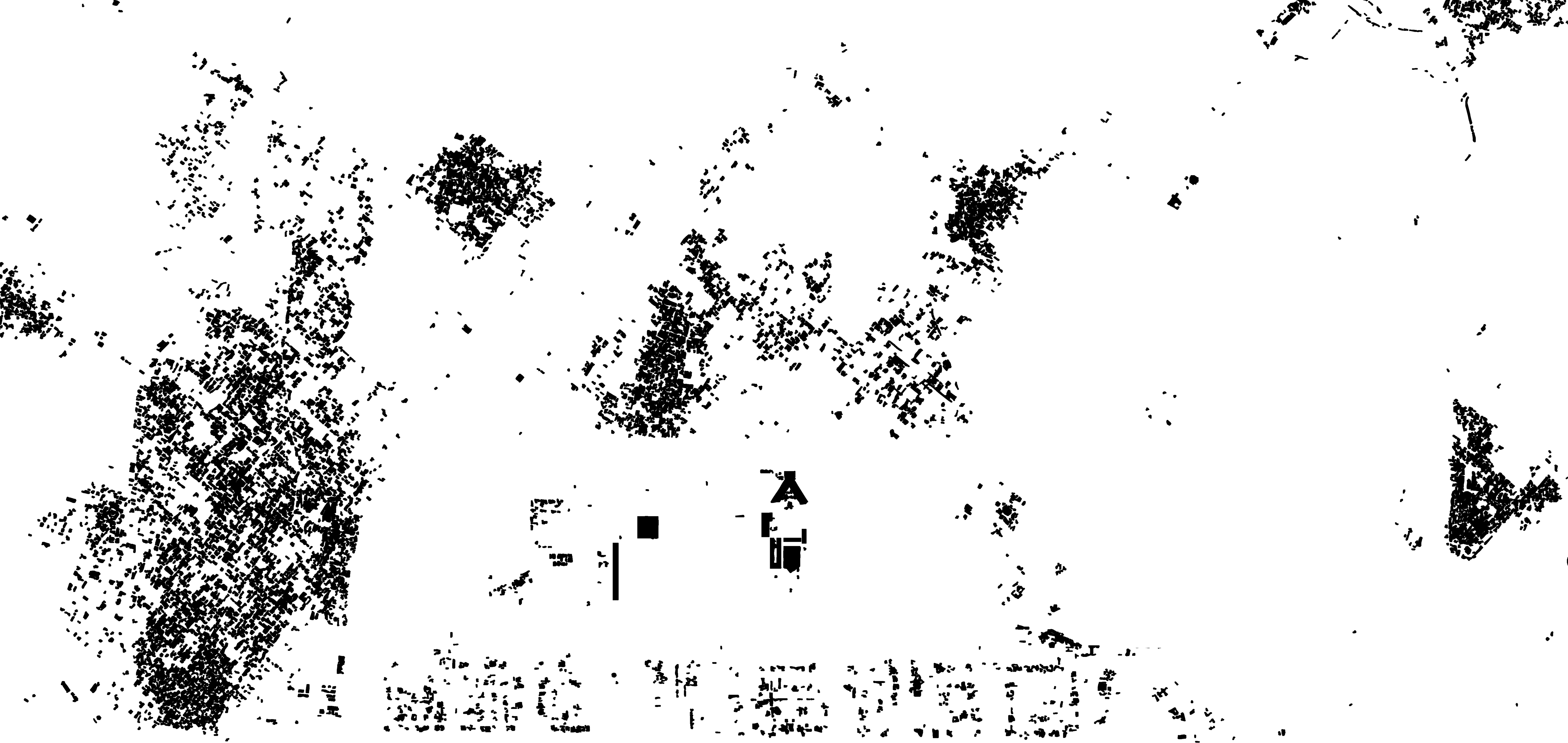
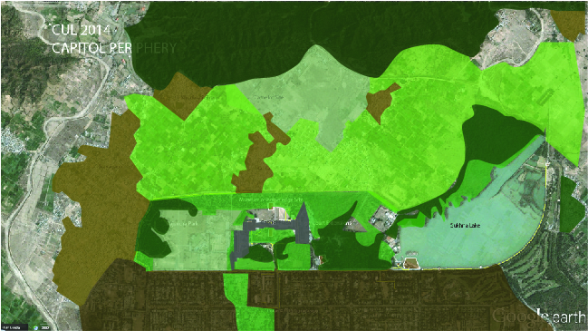
The figure-ground discloses three conditions – 1. At the center is the extremely low footprint of the Capitol Complex. This figure ground is, however, deceptive in part, because the Secreteriat [...]
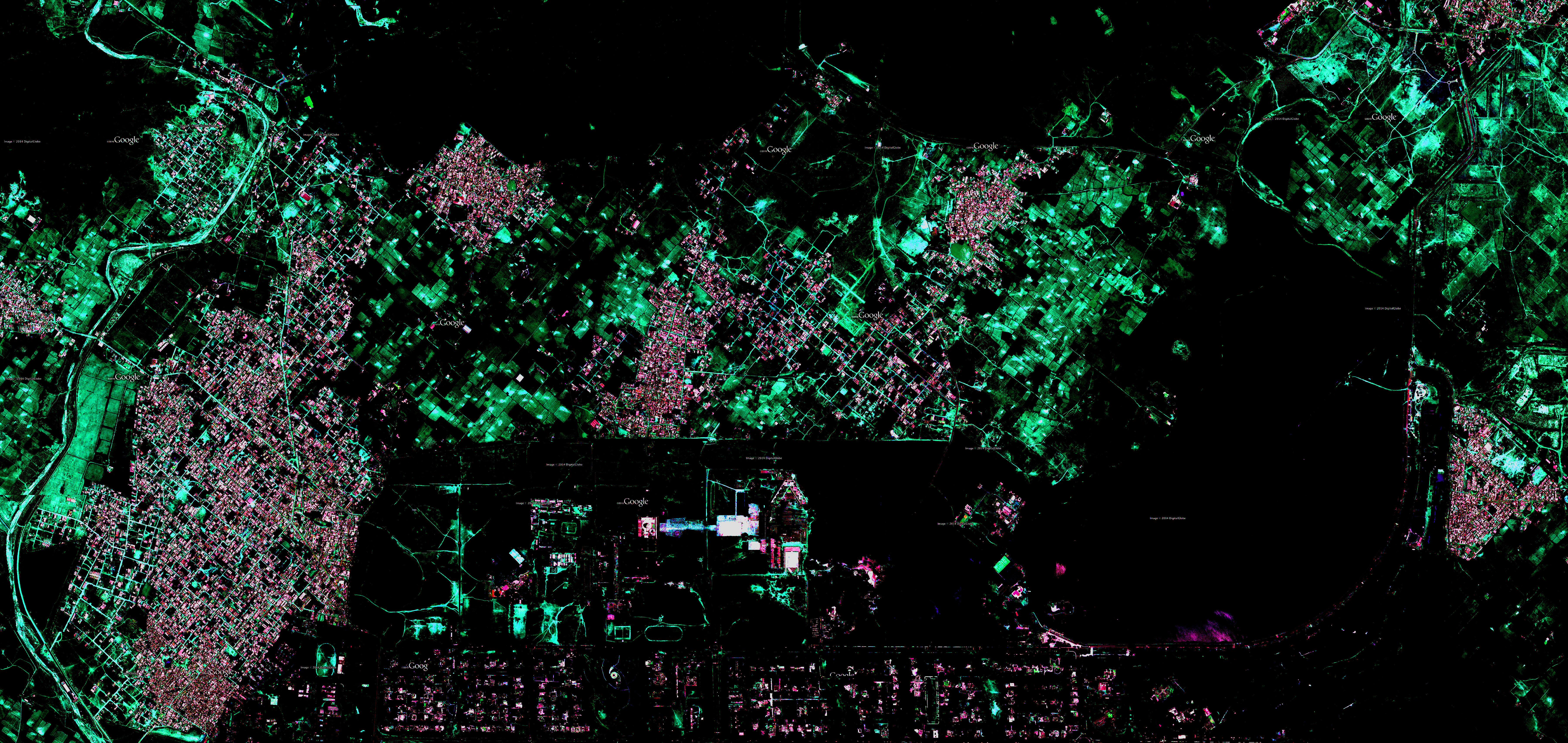
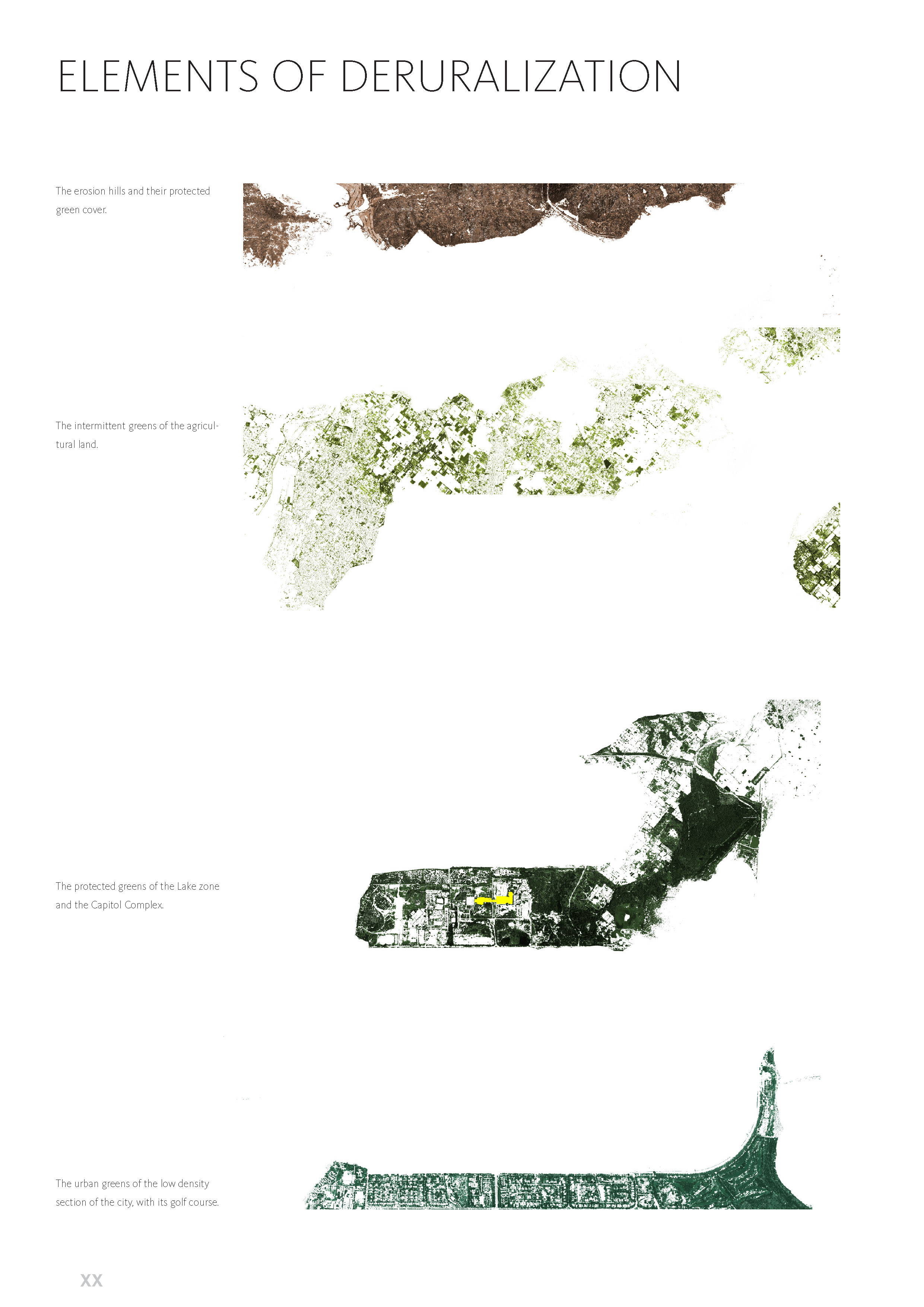
The current green cover and land uses clearly show the distinction between the lands of the Capitol Complex and its adjacencies (i.e Sector 1), and the rural hinterland to its North. While the former [...]
Before the creation of Chandigarh, the local villages of the northern periphery were located right at the edge of the Shivalik Hills, or upstream in the river valleys on the meander terraces of the [...]
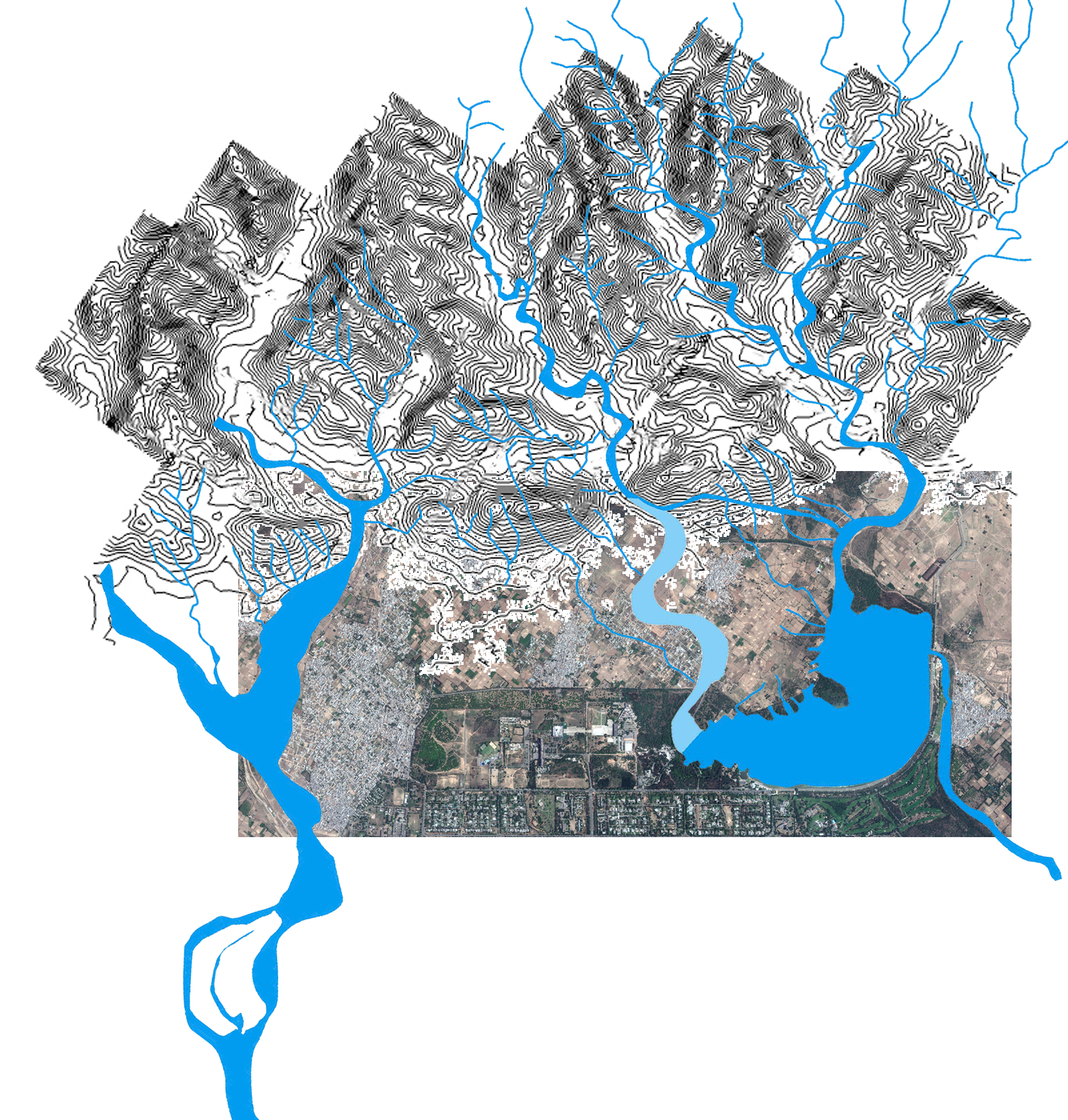
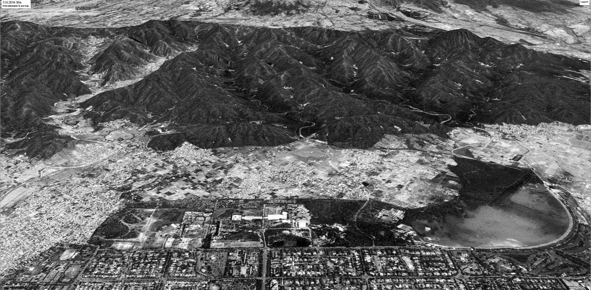
The Shivaliks hills, seen here peeling off from the main mass of the Himalayan mountains, are in fact erosion hills created by the run off from the Himalayas. They are thus unstable ‘mounds’, [...]
The system of the Choes that determine the the hydrology of the Chandigarh site, and of the Capitol and its northern periphery in particular. Note in particular that the choe on the right, which [...]
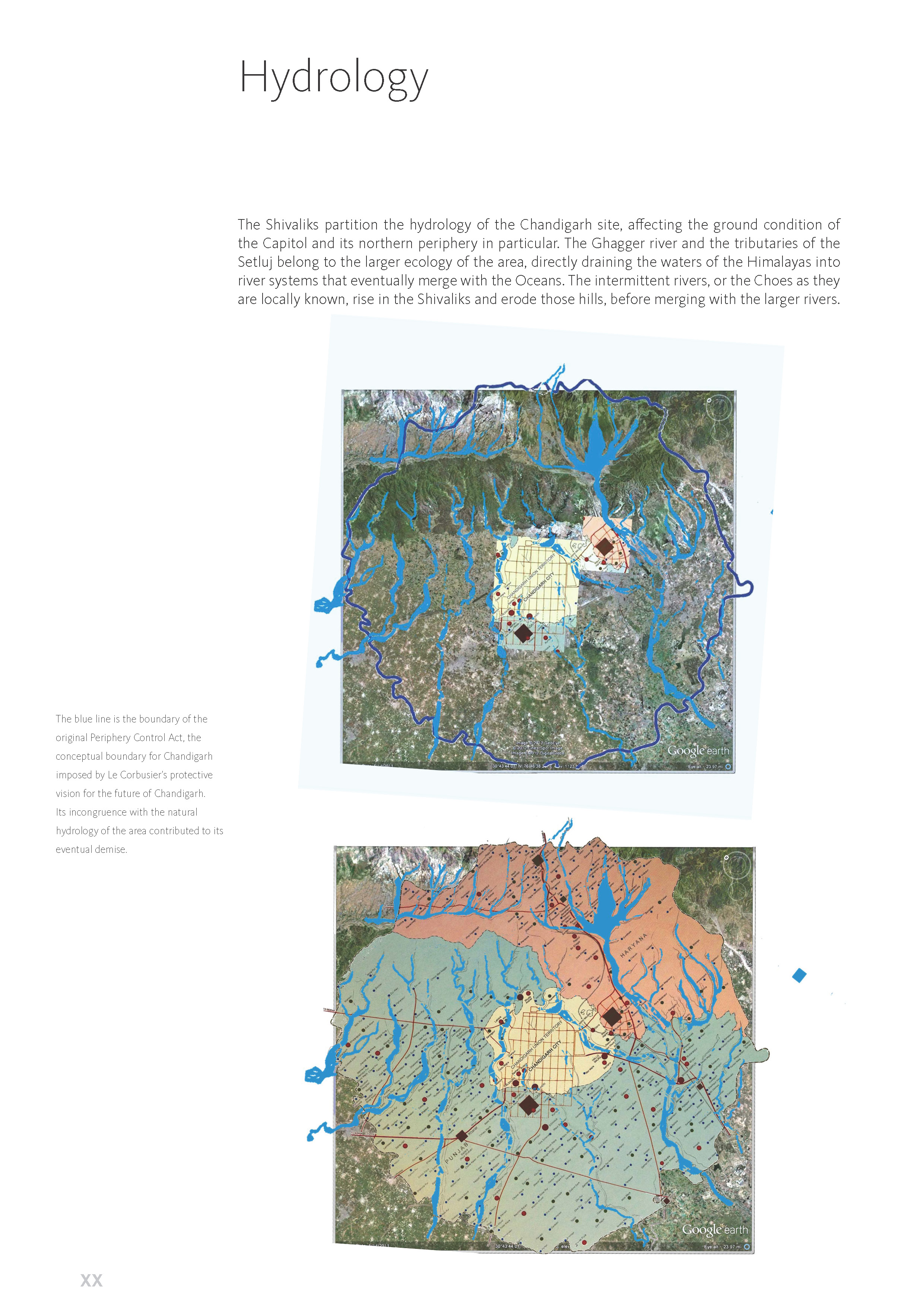
The Shivalik Hills partition the hydrology of the Chandigarh site, affecting the ground condition of the Capitol and its northern periphery in particular. The Ghagger river and the tributaries of the [...]
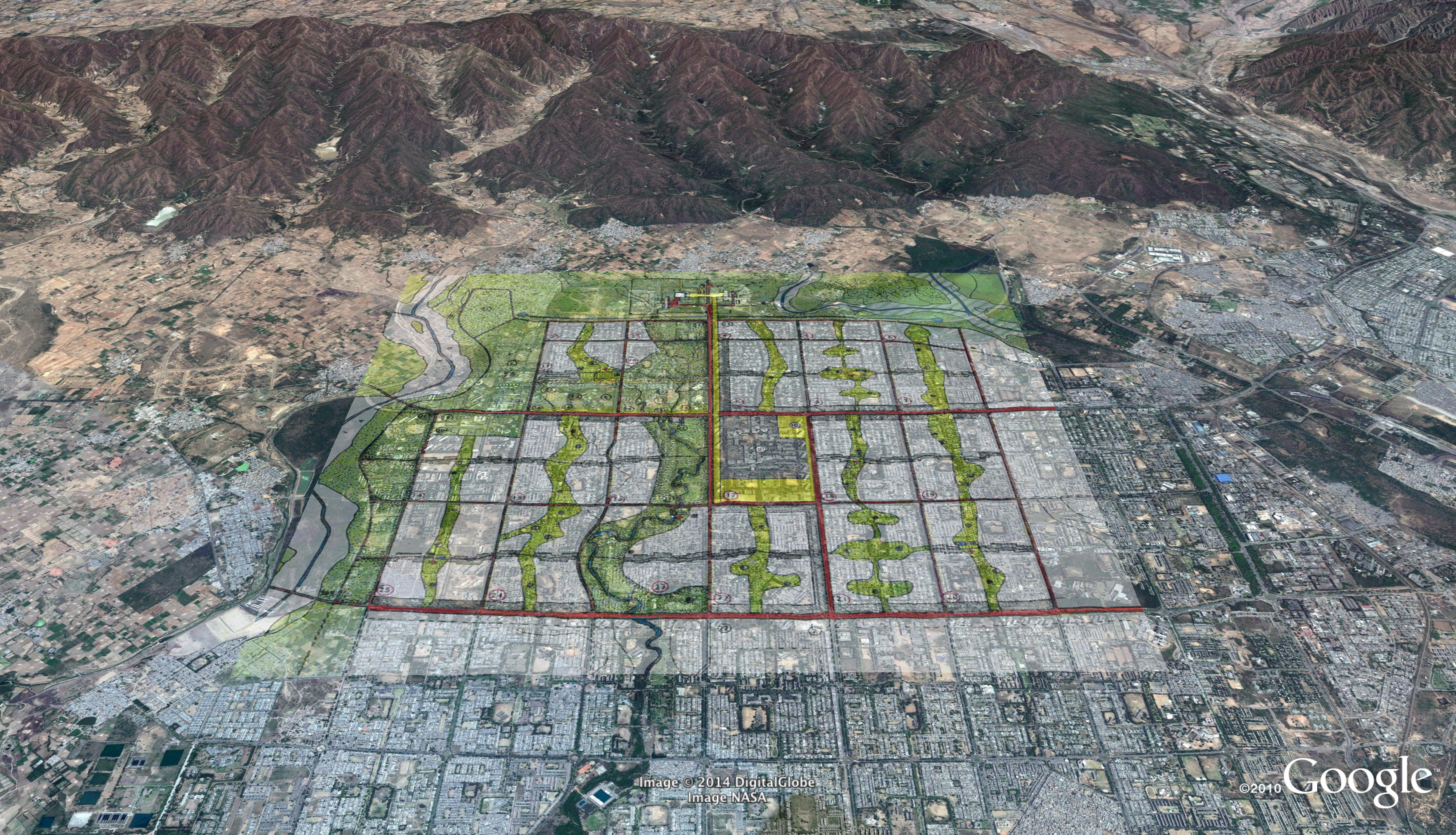
By placing the original plan on the inclined plain, with the full range of the Shivalik Hills in high relief, we can see how the local intermittent rivers carry on their work of breaking down the [...]
Site analysis can of course be done in many different registers. Taking the cue from Le Corbusier, we have choses to work in two modes – the aerial mode, looking at things from the sky, [...]